Human Ecology and Urban Spatial Models
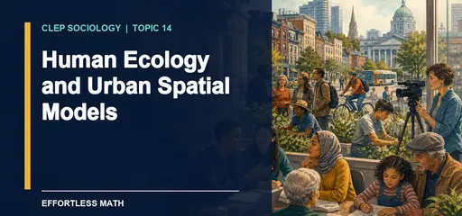
Chapter 14 of the CLEP Sociology study guide on Effortless Math covers Human Ecology and Urban Spatial Models: the key terms, the core ideas, and worked examples showing how this topic is tested on the exam.

CLEP Sociology – Chapter 14
Human Ecology and Urban Spatial Models
CLEP Introductory Sociology · Chapter 14
Human Ecology and Urban Spatial Models
Human ecology studies how populations and institutions adapt to and organize social and physical environments. Early urban sociologists examined how groups and activities compete for space, form concentrations, centralize, segregate, and succeed one another.
The ecological language describes spatial processes, but politics and history shape them. Banks, developers, employers, governments, landlords, and residents influence land prices, credit, zoning, transport, and public investment. A neighborhood pattern is social rather than the automatic outcome of neutral competition.
Ernest Burgess’s concentric-zone model depicts urban growth in rings around a central business district. A transition zone lies near the center, followed by working-class and more affluent residential areas farther outward.
Homer Hoyt’s sector model depicts wedge-shaped corridors extending from the center along rail lines, highways, waterfronts, or other transport routes. Direction along a route matters more than simple distance from downtown.
Harris and Ullman’s multiple-nuclei model depicts a region with several activity centers. A historic downtown, airport employment zone, university district, industrial center, and suburban office cluster can organize different land uses around several nodes.
Match the model to the geometry in the evidence. Rings suggest concentric zones. Wedges along transport suggest sectors. Several centers suggest multiple nuclei. A city can display parts of all three because development occurs in layers.
The models were built from particular historical cities. Topography, highways, zoning, segregation, suburbanization, deindustrialization, annexation, and global investment can redirect a pattern. They are comparison tools rather than universal stages of urban development.
Invasion and succession describe one population or land use entering and gradually replacing another. The words do not explain whether displacement resulted from choice, eviction, credit, urban renewal, or zoning. Causal explanation needs evidence about the mechanism.
Map reading should separate description from cause. Several employment centers support a multiple-nuclei description. Explaining why a center grew near an airport requires evidence about transport, land price, planning, and firm location.
Human ecology also examines feedback. A highway changes access, access changes land value, land value changes housing and business location, and those changes create pressure for more transport. Institutions choose which feedback receives investment and which neighborhoods absorb cost.
Researchers can test a model with land-use maps, employment locations, commuting flows, housing values, and change across several dates. A ring visible today may be the remaining trace of an older industrial boundary rather than evidence that current growth still follows the concentric pattern. Comparing maps through time helps distinguish inherited form from the process now directing development.
Spatial models organize observation. They do not explain every line on a map. A ring of lower-cost housing near an old industrial center may resemble the concentric-zone model, but zoning, rail lines, racial exclusion, and factory pollution can explain why that ring formed. A wedge of development along a highway fits the sector model’s shape. Several office, airport, university, and retail centers fit multiple nuclei. History and policy decide which mechanism deserves credit.
Human ecology once emphasized competition for land, concentration, centralization, and succession as populations and institutions adjusted to space. Those processes remain useful, but “natural” competition cannot explain decisions made through law and power. Redlining, highway construction, annexation, public housing placement, and lending rules direct settlement. Evidence should connect a proposed process to changes over time. A map of one year can show clustering. Parcel records, policy dates, migration flows, and interviews can show how the cluster developed. Avoid the ecological fallacy too. A neighborhood average does not describe every resident within it.
Scale can change the visible pattern. A district may look mixed at the city level while each block remains highly segregated. The reverse can happen when several internally mixed neighborhoods sit inside sharply unequal municipalities. State the unit before deciding which model fits. Then ask what process created the pattern at that scale. A multiple-nuclei description of job centers does not by itself explain unequal travel times, because transit routes, work schedules, and residential access determine who can reach those centers.
Quick review: Concentric-zone means rings around one center. Sector means wedges along routes. Multiple-nuclei means several centers. Human ecology studies population and institution relationships with environments. A model describes spatial form, while history and policy explain its production.
Watch the lesson connection
How Are Cities Organized? gives you a second explanation of the ideas surrounding this lesson. As you watch, pause when the lesson concept appears and explain how the example fits.
Use this lesson for CLEP practice
Write one original example, one close nonexample, and one observation that would help you choose between them. This turns vocabulary recognition into the kind of applied reasoning the exam expects.

Related to This Article
More math articles
- Grade 2 Math Worksheets for Massachusetts — Free and Printable
- 8th Grade IAR Math Worksheets: FREE & Printable
- Socialization, Inequality, and Agency
- 8th Grade ILEARN Math Worksheets: FREE & Printable
- Executive Office of the President
- DNA Replication Enzymes
- How to Multiply and Divide in Scientific Notation? (+FREE Worksheet!)
- How to Simplify Polynomials? (+FREE Worksheet!)
- Subject-Verb Agreement
- How To Choose the Right DAT Course?


















What people say about "Human Ecology and Urban Spatial Models | CLEP Sociology"?
No one replied yet.